LITTLE ROCK – The bad news is that Arkansas duck numbers are down compared to the average for the last four years. But the good news is that numbers could be bolstered in the coming days by the passage of a winter weather system.
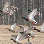
Last week’s aerial waterfowl survey showed a population estimate that’s much lower than the 2009-2012 average. Based on observations by Arkansas Game and Fish Commission biologists, the state’s Delta has an estimated duck population of less than 800,000 ducks, a number similar to what biologists counted during the November survey but a significant decline from the 2009-2012 average for the December survey period.
Large concentrations of ducks were observed at Bald Knob National Wildlife Refuge, Cache River NWR near Dixie, Lake Ashbaugh on Dave Donaldson Black River Wildlife Management Area, Big Lake NWR and Claypool’s Reservoir. Observers saw fewer large concentrations of ducks south of Interstate 40.
In southwest Arkansas, observers counted an estimated 17,000 ducks, including about 10,000 mallards, and in the Arkansas River Valley, observers estimated a population of about 24,000 ducks, including roughly 14,000 mallards.
A winter storm currently making its way across the nation’s midsection may be cause for cautious optimism as duck season’s second segment winds down this weekend. A strong cold front is forecast to dump several inches to more than a foot of snow across parts of Kansas, Nebraska, Iowa and Missouri. In Arkansas, temperatures are predicted to drop into the upper 20s at night with high temperatures in the lower 50s.
The second segment of the state’s duck season closes at sunset Sunday, Dec. 23. The season reopens for the final segment on Dec.26 and runs through Jan. 27.
While this waterfowl report seeks to provide information that is as timely as possible, hunters should keep in mind there’s often a lag of two or three days between the time field reports are received and this report is published. Thus, actual water levels and percentage of flooded habitat may differ from what’s reported here. The AGFC encourages hunters to check stream gauges (links are provided at the end of this report) and physically scout potential hunting areas to determine actual field conditions.
To assist waterfowl hunters with the latest information, the AGFC provides links to sources on waterfowl location and abundance in Arkansas and other states. Maps showing graphical results of this season’s first aerial waterfowl survey are included. The links are available here.
This waterfowl report provides capsule information from agency staff in all corners of Arkansas and is updated each Wednesday throughout waterfowl season. To receive the report each week on your computer, send an e-mail to Arkansas Game & Fish and type “Waterfowl Report” in the subject line. Information on river levels can be found here.
Sunrise/sunset tables are available here and in the Arkansas Waterfowl Regulations Guide.
| Area | Impoundment | Habitat | Water Levels | Weather | Comments |
| Dave Donaldson Black River WMAView Current Gauge Readings | Upper Island GTR
Lower Island GTR Upper Reyno GTR Lower Reyno GTR Winchester GTR |
Good to above average mast production
Good to above average mast production Good to above average mast production Good to above average mast production Good to above average mast production |
269.4 msl. Target level is 269.5 msl.98% flooded.
268.0 msl. Target level is 268.0. 100% flooded. 267.0 msl. Target level is 267.5. 90% flooded. 266.3 msl. Target level is 267.0. 85% flooded. 266.3 msl. Target level is 265 msl. 100% flooded. |
View current weather conditions and forecast for Delaplaine, Arkansas |
Waterfowl hunters should be aware of remnant ice storm damage in the GTRs. Please exercise caution when accessing the area.
Please keep boats off the levees so AGFC personnel can access the area. Boats blocking access will be moved.
Unattended trailers are not to be left overnight on parking areas.
|
| Area | Impoundment | Habitat | Water Levels | Weather | Comments |
| Shirey Bay Rainey Brake WMA | Adam’s Brake GTR
Rainey Brake GTR Phase III Charles Crisp Ward Field River Field |
Fair mast crop
Fair mast crop Good moist-soil vegetation and volunteer millet production Good millet production Poor wetland vegetation Good wetland vegetation |
100%
100% 100% 0% 100% 0% |
View current weather conditions and forecast for Lynn, Arkansas |
.
|
| Area | Impoundment | Habitat | Water Levels | Weather | Comments |
| St. Francis Sunken Lands WMA |
Hunt Area
Snowden WRA Payneway WRA |
Fair mast production
Fair stand of beneficial wetland plants in the borrow areas. Fair stand of beneficial wetland plants in Units C and D, and in the borrow areas. |
Water levels in huntable areas are dependent on St. Francis River flows. The water level at Oak Donnick is 208.74 feet., and approximately 60% of the huntable area is flooded.
0% 0% |
View current weather conditions and forecast for Trumann, Arkansas | Area Info and Map
St. Francis Lake is being drawn down to make emergency repairs to an eroded area near the dam. Access to the lake may be obtained by the Siphons Boat Ramp. Waterfowl hunters should be aware of low water levels along the river channel and the lake area. Please exercise caution when accessing the area.
|
| Area | Impoundment | Habitat | Water Levels | Weather | Comments |
| Earl Buss Bayou DeView WMA |
South Oliver GTR
Thompson Tract GTR Lake Hogue WRA |
Good acorn production
Good acorn production A small amount of beneficial wetland plants along the east side of the lake |
10% flooded, with most water within the natural sloughs
25% flooded Normal |
View current weather conditions and forecast for Weiner, Arkansas | Area Info and Map
Boaters should use caution while using the Thompson Tract boat run.
|
| Area | Impoundment | Habitat | Water Levels | Weather | Comments |
| Big Lake WMA |
North Woods GTR
South Woods GTR Simmons Field |
Good mast production
Good mast production A fair amount of millet and sedge is present. Seed production is fair. |
The Bois d’Arc gauge is currently at 234.2 msl. Target water level is 235.5 msl. The area is 30% flooded.
The 7-Mile gauge is currently at 233.4 msl. Target water is 234.5. The area is 40% flooded. 15% |
View current weather conditions and forecast for Manila, Arkansas | Area Info and Map |
| Area | Impoundment | Habitat | Water Levels | Weather | Comments |
| Bell Slough WMA |
Bell Slough GTR
Palarm Creek Waterfowl Rest Area |
Fair mast crop
Fair seed production on natural vegetation |
100%
35% |
View current weather conditions and forecast for Mayflower, Arkansas | Area Info and Map |
| Area | Impoundment | Habitat | Water Levels | Weather | Comments |
| Holland Bottoms WMA |
Hunt Area
Lake Pickthorne Waterfowl Rest Area |
Good conditions and a
good mast crop Good conditions |
Dry
East cell is 100% flooded; west cell is 20% flooded with a good stand of millet. |
View current weather conditions and forecast for Cabot, Arkansas | |
| Area | Impoundment | Habitat | Water Levels | Weather | Comments |
| Harris Brake WMA | Harris Brake GTRs | Poor acorn crop |
Lower unit is 100% flooded.
|
View current weather conditions and forecast for Perryville, Arkansas | Area Info and Map
The upper unit is 80% flooded.
|
| Area | Impoundment | Habitat | Water Levels | Weather | Comments |
| Craig D. Campbell Lake Conway Reservoir | Waterfowl hunting is open until noon on Pierce Creek, Dix Creek, Palarm Creek Bay and Caney Creek Bay. | Normal | Stable | View current weather conditions and forecast for Mayflower, Arkansas | Area Info and Map |
| Area | Impoundment | Habitat | Water Levels | Weather | Comments |
| Henry Gray Hurricane Lake WMA |
North GTR
South GTR |
Good mast crop.
Good acorn crop. |
Dry, with some water in the lakes
Dry, with some water in the lakes |
View current weather conditions and forecast for Bald Knob, Arkansas | Area Info and Map
Only water available is in the lakes, but they’re low.
|
| Area | Impoundment | Habitat | Water Levels | Weather | Comments |
| Steve N. Wilson Raft Creek Bottoms WMA | Units A, B, & C
Unit H (Mobility-impaired Blind)
Units D & E
Units F & G
|
Units A, B and C: Good stand of millet and a variety of sedges
Unit H: Fair stand of smartweed and wild millet and a variety of sedges
Units E and F: Fair stand of smartweed, wild millet and a variety of sedges
Unit G: This unit is designed as a permanent water source; food availability is fair around the shallow edges.
Unit I: Good stand of millet and a variety of sedges
|
Units A, B and C are about 100% flooded and are accessible by boat.
Unit H is 100% flooded and is accessible by ATV (disabled hunters only).
Unit E is 70% flooded. Unit F is at 25%. Both units are accessible by foot and boat.
Unit G: Full pool; accessible by foot traffic only
Unit I: 85% flooded; accessible by foot traffic only
|
View current weather conditions and forecast for Georgetown, Arkansas | Area Info and Map |
| Area | Impoundment | Habitat | Water Levels | Weather | Comments |
| Rex Hancock Black Swamp WMA |
Main WMA
Wiville Unit
|
Good mast crop |
Area is about 50% flooded after a rise in the Cache River. Access by boat is still limited on the area.
Wiville unit is approximately 14 acres and is 100% flooded. Access by foot traffic only.
|
View current weather conditions and forecast for Cotton Plant, Arkansas | Area Info and Map |
| Area | Impoundment | Habitat | Water Levels | Weather | Comments |
| Sheffield Nelson Dagmar WMA |
Mud Slough GTR
Apple Lake WRA |
Good mast crop
Good mast crop |
Dry
Lake level is low. |
View current weather conditions and forecast for Cotton Plant, Arkansas | Area Info and Map
|
| Area | Impoundment | Habitat | Water Levels | Weather | Comments |
| Bayou Meto WMA |
Upper Vallier GTR
Lower Vallier GTR Government Cypress GTR Buckingham Flats GTR Temple Island GTR Halowell WRA Wrape Plantation WRA |
Good mast crop
Good mast crop Good mast crop Good mast crop Good mast crop Good moist-soil habitat Good moist-soil habitat |
178.6 msl. Full pool is at 180.0 msl.
178.6 msl. Full pool is at 179.0 msl. 178.6 msl. Full pool is at 179.0 msl. 100% 85%
Staggered unit flooding Staggered unit flooding |
View current weather conditions and forecast for Humphrey, Arkansas | Area Info and Map
All boat ramps are accessible.
|
| Area | Impoundment | Habitat | Water Levels | Weather | Comments |
| Cut-Off Creek WMA | Hunt Area
Pigeon Creek Waterfowl Rest Area |
Good mast crop
Good mast crop |
Water is in sloughs only. A few wood ducks are in the area.
100% flooded |
View current weather conditions and forecast for Collins, Arkansas | Area Info and Map |
| Area | Impoundment | Habitat | Water Levels | Weather | Comments |
| Seven Devils Swamp WMA | Good | 90% flooded | View current weather conditions and forecast for Collins, Arkansas | Area Info and Map | |
| Area | Impoundment | Habitat | Water Levels | Weather | Comments |
| Trusten Holder WMA | Arkansas River Below Pendleton Bridge, including Post Lake, Merrisach Lake and Moore’s Bayou. | Good mast crop | Arkansas River is at 26.34 feet on Pendleton gauge. | View current weather conditions and forecast for Yancopin, Arkansas | Area Info and Map
Variable backwater levels
|
| Area | Impoundment | Habitat | Water Levels | Weather | Comments |
| Freddie Black Choctaw Island WMA Deer Research Area | Mississippi River | River bottoms | Mississippi River is at 10.07 feet on the Arkansas City gauge. Old River Boat Ramp is not accessible. | View current weather conditions and forecast for Arkansas City, Arkansas | Area Info and Map
Variable backwater levels. River water only. Pothole Lake not accessible from Kate Adams Lake.
|
| Area | Impoundment | Habitat | Water Levels | Weather | Comments |
| Beryl Anthony Lower Ouachita WMA | Good mast crop | Dry | View current weather conditions and forecast for Huttig, Arkansas | Area Info and Map | |
| Area | Impoundment | Habitat | Water Levels | Weather | Comments |
| Dr. Lester Sitzes, III Bois d’ Arc WMA | Bois d’ Arc Lake WRA
Red Slough WRA GTR Little Grassy |
Closed to hunting.
Closed to hunting. Good mast production Habitat is fair. |
Low
25% 15% 0% |
View current weather conditions and forecast for Texarkana, Arkansas |
The water level on the last report was incorrect. |
| Area | Impoundment | Habitat | Water Levels | Weather | Comments |
| Millwood Lake | Habitat conditions are good. | 259.48 Normal is 259.20 | View current weather conditions and forecast for Texarkana, Arkansas | Area Info and Map | |
| Area | Impoundment | Habitat | Water Levels | Weather | Comments |
| Sulphur River WMA |
Mercer Bayou
Henry Moore WRA |
Closed to hunting. |
Water level is 1 foot below normal pool.
60% flooded
|
View current weather conditions and forecast for Texarkana, Arkansas |
Recent rains did not significantly improve water levels. |
| Area | Impoundment | Habitat | Water Levels | Weather | Comments |
| Ed Gordon Point Remove WMA |
Willow Island Little Hole Red Gate Pig Trough Cedar Ridge Duck Trap Salt Lick Bobby’s Pond Race Track Controversy Corner Remmel Marsh Mud Pond Turkey Pond Teeny Pond |
Natural vegetation
Natural vegetation Natural vegetation Natural vegetation Natural vegetation Millet/Natural vegetation Millet/Natural vegetation Natural vegetation Natural vegetation Natural vegetation Millet/Natural vegetation Natural vegetation Millet/Natural vegetation Natural vegetation |
0% 0% 90% 0% 0% 60% 0% 0% 0% 100% 100% 0% 0% 0% |
|
Area Info and Map
As of Dec. 17, both Controversy Corner and Remmel Marsh MSUs are at full capacity. Red Gate MSU is approximately 90% full, and Duck Trap MSU is approximately 60% full. Although millet was planted in several cells, it succumbed to dry conditions, with only moderate stands in Remmel Marsh and Duck Trap. Duck numbers on the cells holding water have generally been low to moderate, and hunter success has been poor to fair.
|
| Area | Impoundment | Habitat | Water Levels | Weather | Comments |
| Petit Jean River WMA | Santa Fe GTR
Olin Cain MSU Blacklands MSU Slaty Crossing MSUs Pullen Pond Pond Creek GTR Slaty Pond GTR Black Lands Duck Area |
|
5%
100% 95% 0% 0% 5% 0% 100% |
View current weather conditions and forecast for Ola, Arkansas | Area Info and Map
The Petit Jean River level at Centerville is currently at 2.44 feet.
|
| Area | Impoundment | Habitat | Water Levels | Weather | Comments |
| Galla Creek WMA | Galla Creek GTR | Natural vegetation including mixture of buttonbush and smartweed. | 0% | View current weather conditions and forecast for Pottsville, Arkansas |
The GTR will not be flooded this year because of ongoing reforestation efforts.
|
| Area | Impoundment | Habitat | Water Levels | Weather | Comments |
| Frog Bayou WMA |
Unit 1
Unit 2 Unit 3 Unit 4 Unit 5 Unit 6 Unit 7 |
Native moist soil plants
Native moist soil Millet Native moist soil Native moist soil Millet Native moist soil |
Unit 1 is full
Unit 2 is dry Unit 3 is full Unit 4 is 50% flooded. Unit 5 is 50% flooded. Unit 6 is full. Unit 7 is dry |
View current weather conditions and forecast for Alma, Arkansas | Area Info and Map |
| Area | Impoundment | Habitat | Water Levels | Weather | Comments |
| Lloyd Millwood Nimrod WMA | Nimrod GTR | Poor mast crop and native grasses. | 15% | View current weather conditions and forecast for Plainview, Arkansas |
The river level is too low to pump. Needs to be above 343 msl. Currently at 342.32.
|
| Area | Impoundment | Habitat | Water Levels | Weather | Comments |
| Ozark Pool
|
Dyer Lake Cells |
Some millet in east cells; plantings failed in south and west cells. | East cells are fully flooded; South and west cells are dry. | View current weather conditions and forecast for Dyer, Arkansas | |
| Area | Impoundment | Habitat | Water Levels | Weather | Comments |
| Dardanelle WMA |
Johnson County WRA
McKennon Bottoms Potter’s Pothole/Hartman Waterfowl Unit |
Moist soil vegetation, including millet, are good.
Habitat is fair to good.
|
60%
100% 0% |
View current weather conditions and forecast for Clarksville, Arkansas |
The water level at Horse Head Creek is too low to pump.
|
Related Posts
 Waterfowl Report says Habitat, Weather Conditions Slowly Improving
 Arkansas Waterfowl Report – Pieces Coming Together for Duck Hunters
- Cold Weather Arrives Early For 2014 Arkansas Duck Season
 Waterfowl Report Shows Habitat Vastly Improved After Heavy Rainfall
- Conditions Improve Slightly for Duck Season’s 2nd Segment
 Arkansan Named to Ducks Unlimited Board of Directors